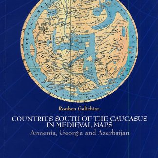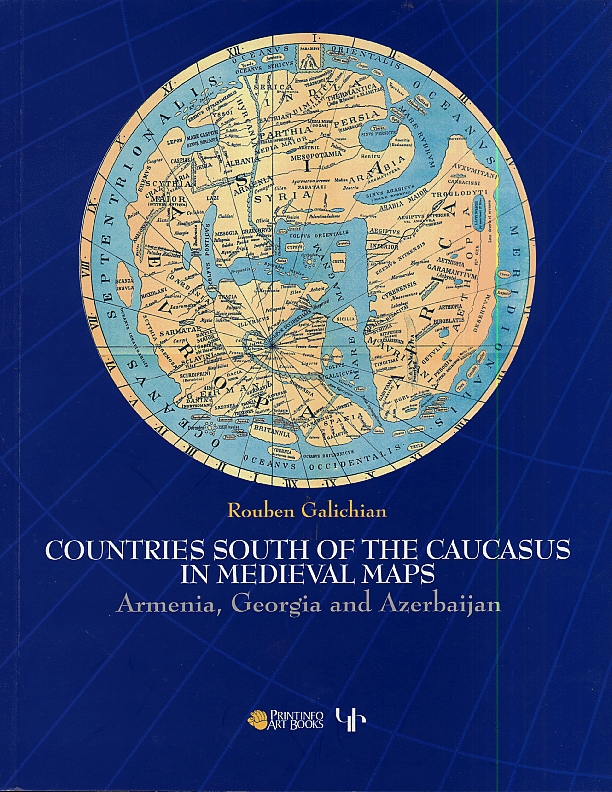
Countries South of the Caucasus in Medieval Maps
Armenia, Georgia and Azerbaijan
- Rouben Galichian (Author)
$55.00
Additional information
| Pages | 208 Pages |
|---|---|
| Weight | 2.5 lbs |
| Dimensions | 8.75 × 11 in |
Related products
-
 $4.95
Add to cart
$4.95
Add to cart
-
 $14.95 Add to cart
Hay Grakanutyan Kristomatia 8
Armenian Literature Reader 8: Textbook for 8th Grade Secondary School
Azat Yeghiazaryan (Author), Zarik M. Grigoryan (Author) -
 $7.95
Add to cart
$7.95
Add to cart